The Chase Map collection contains 23 digitally available maps of Winchester resident and graphic artist Ernest Dudley Chase (1878-1966). Depicted countries include Denmark, England, Germany, Norway, Portugal, Spain, Sweden, Switzerland, and the United States. The collection also includes maps of Winchester, Boston, and New York City. It is noted under each citation whether the individual map is black and white or color, signed or unsigned, and the dimensions of each item. His pictorial maps include historical references, decorative borders, and architectural embellishments. Other repositories that hold Ernest Dudley Chase maps include: State Library of Massachusetts, the Norman B. Leventhal Map Center, and University of Wisconsin at Milwaukee.
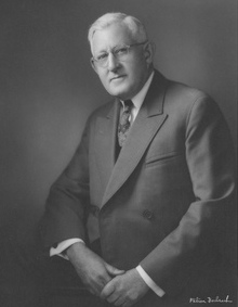
Widely regarded for his drawings, greeting cards, and maps during his lifetime, Ernest Dudley Chase was born in Lowell, MA in 1878. He attended the Lowell Textile School and the Vesper George Art School of Boston. He then joined the Butterfield Printing Company in 1900 and the W. T. Sheehan printing firm in 1906. In 1908, he began his own greeting card company, Des Arts Publishers, which later became Ernest Dudley Chase Publishers. In 1921, the Rust Craft company purchased Ernest Dudley Chase Publishers. Chase held the positions of vice president, advertising manager, and creative director with Rust Craft until his retirement in 1958. Chase also wrote a history of the greeting card industry entitled The Romance of Greeting Cards published in 1926 and a collection of his cards, maps, and travel diaries are held at the Archives Center, National Museum of American History. After a creative and illustrious career, Chase died in 1966 in Hyannis, MA.
Maps
All maps are available as PDFs except one. The black & white version of America the Wonderland is only available as an image. Click on the map image to open the PDF.
Access to the physical collection is by prior arrangement. Please contact us at 781-721-7171 x320 to schedule an appointment.
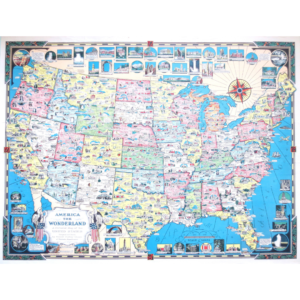
America the Wonderland
Winchester, Mass.: Ernest Dudley Chase, 1940.
Color. Signed. 21.75” x 29” inches.
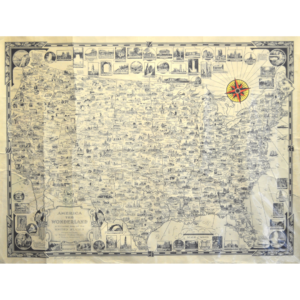
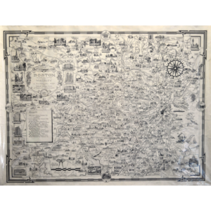
America the Wonderland
Winchester, Mass.: Ernest Dudley Chase, 1940.
Black and white. Unsigned. 25” x 19” inches.
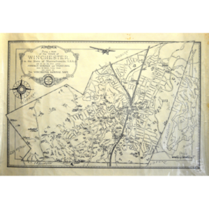
Being a Map of the Town of Winchester Issued by the Winchester National Bank
Winchester, Mass.: Winchester National Bank, 1939.
Black and white. Unsigned. 25” x 17.5” inches.
Boston, Massachusetts and Vicinity
Winchester, Mass.: Ernest Dudley Chase, 1938.
Black and white. Unsigned. 25” x 19” inches.
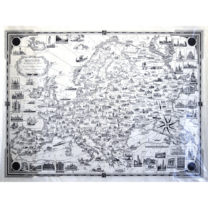
Europe: A Pictorial Map
Winchester, Mass.: Ernest Dudley Chase, 1938.
Black and white. Unsigned. 25” x 19”
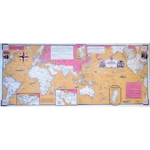
A Factual & Pictorial Map: World Freedom
United States: Ernest Dudley Chase, 1950.
Color. Unsigned. 15.5” x 36” inches.
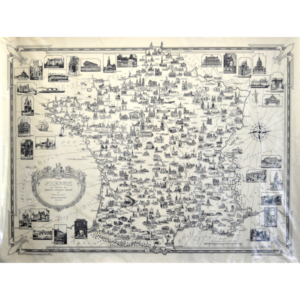
France as drawn by Ernest Dudley Chase
Winchester, Mass.: Ernest Dudley Chase, 1935.
Black and white. Unsigned. 25” x 19” inches.
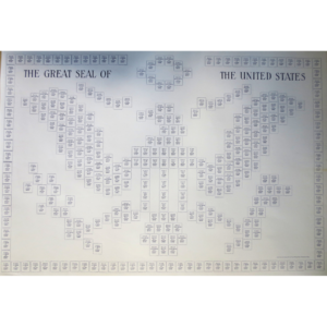
Great Seal of the United States
Winchester, Mass.: Ernest Dudley Chase, undated.
Black and white. Unsigned. 31.75” x 22” inches.
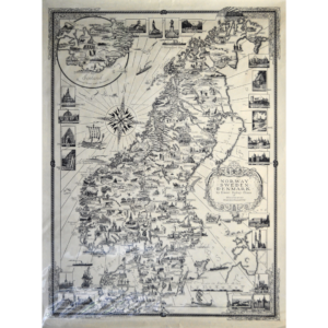
Norway, Sweden, Denmark
Winchester, Mass.: Ernest Dudley Chase, 1937.
Black and white. Unsigned. 25” x 19” inches.
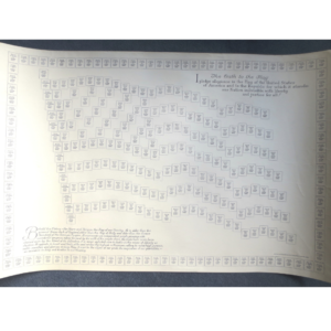
The Oath to the Flag
Winchester, Mass.: Ernest Dudley Chase, undated.
Black and white. Unsigned. 32.5” x 22” inches.
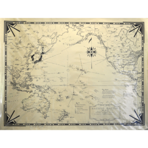
Pacific Battle Map
Winchester, Mass.: Ernest Dudley Chase, 1942.
Black and white. Signed. 25” x 19” inches.
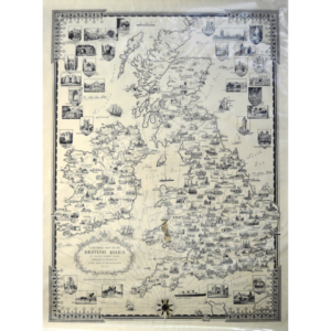
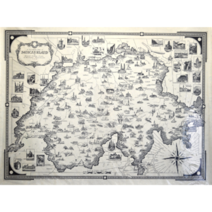
A Pictorial Map of the British Isles
Winchester, Mass.: Ernest Dudley Chase, 1935.
Black and white. Unsigned. 19” x 25” inches.
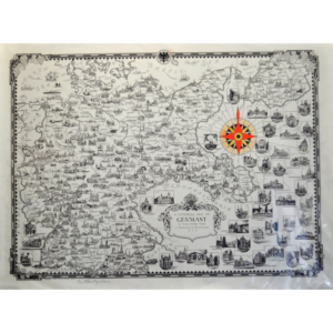
A Pictorial Map of Germany
Winchester, Mass.: Ernest Dudley Chase, 1935.
Black and white. Unsigned. 19” x 25” inches.
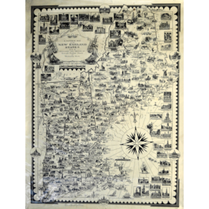
A Pictorial Map of the New England States, USA
Winchester, Mass.: Ernest Dudley Chase, 1935.
Black and white. Signed. 25” x 19” inches.
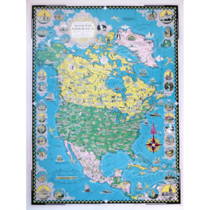
A Pictorial Map of North America
Winchester, Mass.: Ernest Dudley Chase, 1945.
Color. Unsigned. 21.75” x 29” inches.
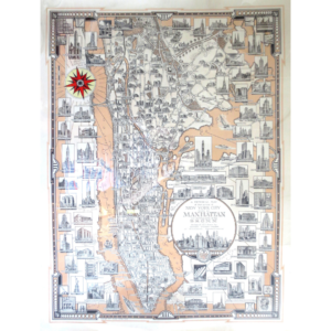
A Pictorial Map of that Portion of New York City know as Manhattan also Showing Parts of the Bronx
Winchester, Mass.: Ernest Dudley Chase, 1939.
Color. Unsigned. 22” x 29” inches.
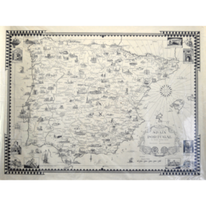
A Pictorial Map of Spain and Portugal
Winchester, Mass.: Ernest Dudley Chase, 1935.
Black and white. Unsigned. 25” x 19” inches.
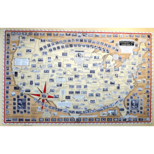
A Pictorial Map: Stamps of America: Dedicated to Philatelists Everywhere
Winchester, Mass.: Ernest Dudley Chase, 1947.
Color. Signed. Research by Charles Peck Kerr. 34” x 22” inches.
A Pictorial Map of Switzerland
Winchester, Mass.: Ernest Dudley Chase, 1936.
Black and white. Unsigned. 25” x 19” inches.
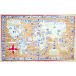
A Pictorial Map: A World of Stamps
Winchester, Mass.: Ernest Dudley Chase, undated.
Color. Unsigned. Research directors: Charles Peck Kerr, C. Beecher Petersen, Ashley C. LeDuc. 34” x 21.5” inches.
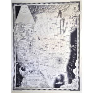
The United States as Viewed by California (very unofficial).
Winchester, Mass.: Ernest Dudley Chase, 1940.
Black and white. Unsigned. 25” x 19”.
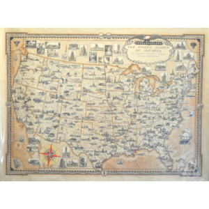
The United States of America
Winchester, Mass.: Ernest Dudley Chase, 1935.
Color. Unsigned. 25” x 18.5” inches.
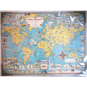
World Wonders: A Pictorial Map
Winchester, Mass.: Ernest Dudley Chase, undated.
Color. Unsigned. 38” x 28” inches.